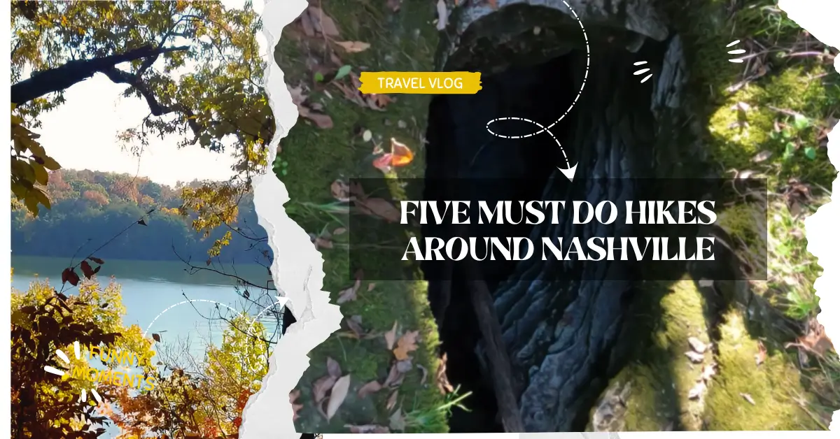
A skyline of neon and a soundtrack of pedal‑steel guitars may headline Nashville’s postcards, yet just beyond the honky‑tonks lie ridges, cedar glades, and river valleys begging for boot prints. Over the past twelve years I have laced up here every month—through dogwood blossom springs, chorus‑frog summers, saffron autumns, and the shy snows of January—and compiled a short list I now hand to visiting friends. These five trails showcase the region’s biodiversity and vistas without demanding technical gear or a three‑hour drive. Bring water, curiosity, and the willingness to trade asphalt for leaf litter.
Trail talk—terms worth knowing
Greenway
A paved multi‑use path, stroller‑friendly and often bike‑heavy; sections intersect some trailheads described below.
Cedar glade
A rare limestone‑exposed habitat dominated by red cedar and drought‑tolerant wildflowers like Tennessee coneflower—endemic to middle Tennessee.
Lollipop loop
A trail that follows a stem out to a loop and then back on the same stem, resembling a candy lollipop on the map.
Tick season
Late March through October; wear treated socks and perform checks after hiking tall‑grass paths.
Leave No Trace
Seven‑principle ethic guiding low‑impact recreation—pack out trash, stay on trail, respect wildlife—all five hikes below follow these guidelines with posted signage.
1. Radnor Lake South Lake and Ganier Ridge Loop
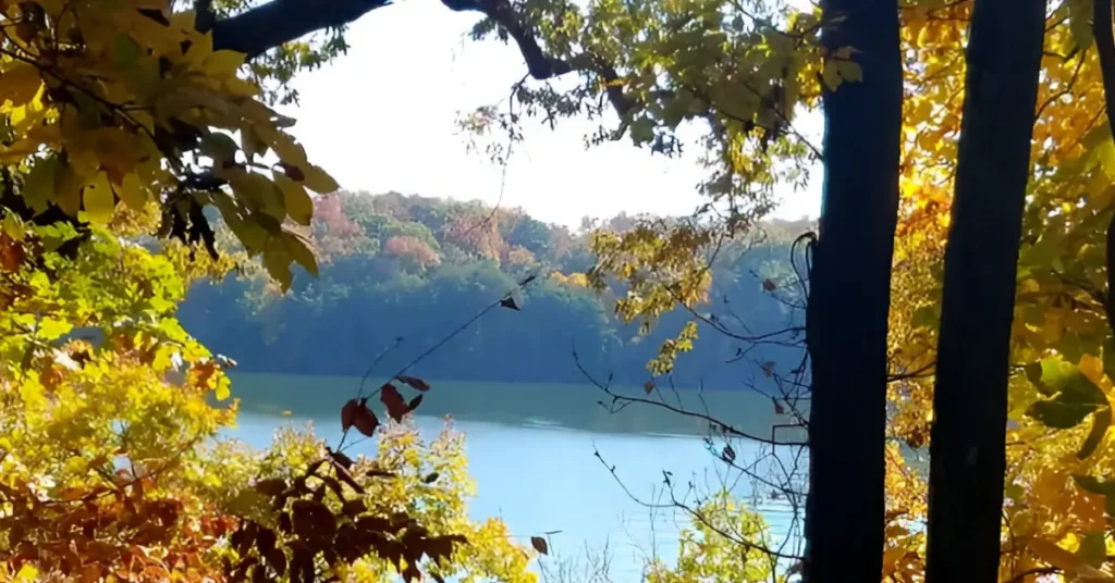
Why it tops my list
I have watched sunrise mist lift off Radnor’s mirror‑still water while barred owls traded hoots overhead—an urban wilderness spectacle ten miles from downtown. The competitor guide mentions only the flat lake edge; they completely miss the ridge that gifts you hawk‑level views.
Trail snapshot
| Metric | Detail |
|---|---|
| Distance | 3.4 mi lollipop loop |
| Elevation gain | 380 ft |
| Difficulty | Easy‑moderate |
| Best season | November–April for migratory waterfowl |
| Dog policy | No pets on trail (strictly enforced) |
| Parking fee | Free, but lots fill by 7 a.m. weekends |
What you’ll see
• Waterfowl blinds on the South Lake Trail provide close‑up looks at wood ducks.
• Climb Ganier Ridge and peer through tulip‑poplar trunks to the Nashville skyline framed by rolling hills.
• Spring ephemerals—trillium, bloodroot—carpet the forest floor mid‑March.
My field notes
• Arrive at the East Lot before sunrise; overflow cars queue on Otter Creek Road and rangers ticket wheels on pavement lines.
• Bring 8×32 binoculars—the resident bald‑eagle pair nests on the lake’s western cove.
• The mulch surface turns slick after rain; trail runners or hiking shoes with moderate lug prevent slides.
2. Mossy Ridge Trail in Percy Warner Park
Why it belongs
This 4.5‑mile loop is my cardio day: quick switchbacks, stone staircases, and four ridge tops, each opening to a different compass bearing. The competitor piece calls it “beloved” but skips specifics such as where to find the quiet overlook and how to link short connectors for easier mileage.
Trail snapshot
| Metric | Detail |
|---|---|
| Distance | 4.5 mi loop (extend to 6 mi with Cane Connector) |
| Elevation gain | 740 ft |
| Difficulty | Moderate—steep in two sections |
| Best season | October for maple color or May for mountain‑laurel bloom |
| Dog policy | Leashed allowed; carry waste out |
| Parking fee | Free; restrooms at Deep Well lot |
Highlights
• Wooden archway entrance at Deep Well sets a fairy‑tale tone.
• Side trail at mile 2 to the signed “Quiet Point” bench—morning fog pools in the valleys below like cream in coffee.
• Cane Connector detour adds rocky gullies, ideal for trail‑running practice.
My field notes
• Trek poles helpful on the stone staircase (built by CCC in the 1930s).
• Cell service cuts out on south slope; download an offline map.
• Pack a snack for the “Quiet Point” bench—chipmunks will dart at crumbs, so mind Leave No Trace.
Hydration reminder
Both trails so far lack potable water. I clip a soft flask to my shoulder strap and refill from the car afterward—Nashville humidity will sneak‑attack you even on 65 °F mornings.
3. Narrows of the Harpeth and Hidden Lake
Why it surprises
A twenty‑minute drive west drops you into limestone cliffs, an 1818 hand‑cut tunnel, and a bluff overlook that photographs like the Ozarks. My first visit in July 2024 turned into an impromptu swim after spotting paddlers below—pack sandals.
Trail snapshot
| Metric | Detail |
|---|---|
| Distance | 1.5 mi total if you string all three spur trails |
| Elevation gain | 210 ft |
| Difficulty | Easy |
| Best season | April–June for wildflowers or October for foliage |
| Dog policy | Leashed; keep to bluff interior for safety |
| Parking fee | Free; gate closes at posted hours |
What adds depth beyond the competitor guide
• Montgomery Bell tunnel geology kiosk at the tunnel mouth explains how enslaved laborers redirected river flow for iron forging—context worth the five‑minute read.
• Hidden Lake side loop hosts endangered spring creek bladderpod; stay on boardwalk flagged sections.
• Bluff overlook faces due west—sunset lights the Harpeth green‑gold; bring a headlamp for the descent.
My field notes
• Canoe traffic peaks holiday weekends, so arrive by 9 a.m. for parking and solitude.
• After rain, limestone turns glassy—non‑slip trail shoes matter.
• A picnic table near the Narrows canoe launch is ideal for post‑hike snacks; no trash bins, so pack out.
4. Volunteer Trail in Long Hunter State Park
Why it feels remote
Though only thirty minutes east of downtown, this shoreline path along Percy Priest Lake trades city sounds for lapping water and osprey cries. I’ve overnighted at the primitive sites twice—waking to fog lifting off the lake is cinematic.
Trail snapshot
| Metric | Detail |
|---|---|
| Distance | 5.5 mi one way (11 mi out‑and‑back) |
| Elevation gain | 430 ft cumulative |
| Difficulty | Moderate stamina, easy footing |
| Best season | September–November for stable weather |
| Dog policy | Leashed; bring extra water for pets |
| Parking fee | Free; register for backcountry site |
Highlights competitor missed
• Backcountry campsites at mile 5.5 include fire rings and lake access—reserve online for $10.
• Heron rookery on a small island visible at mile 3; binoculars reveal nests in early spring.
• Trail markers every half‑mile list distance remaining—great for pacing beginners.
My field notes
• Carry at least 2 L water; none is available on trail.
• Cell coverage weak beyond mile 3; download a GPX track.
• In summer the shoreline offers swim coves—but check for submerged timber before jumping.
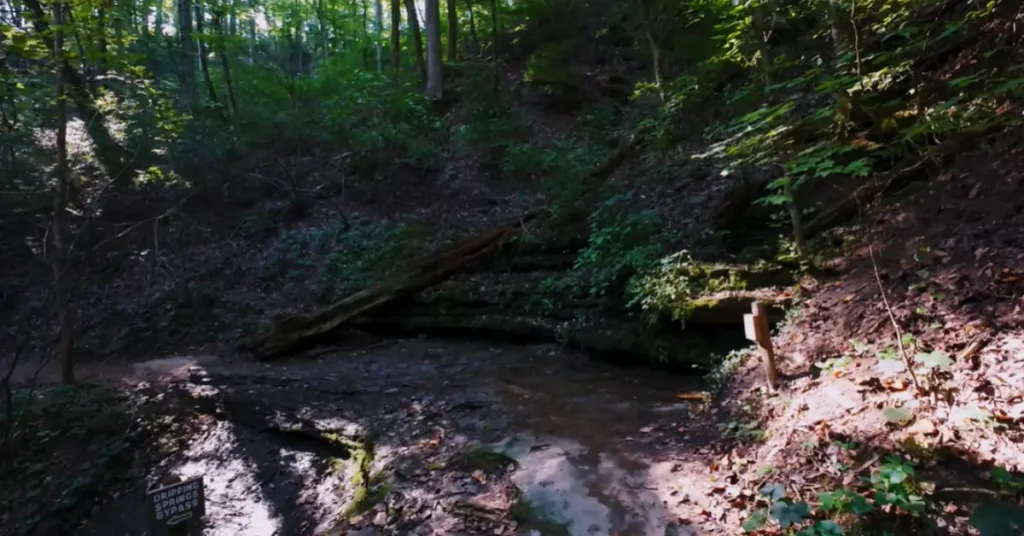
5. Hidden Springs Loop Cedars of Lebanon
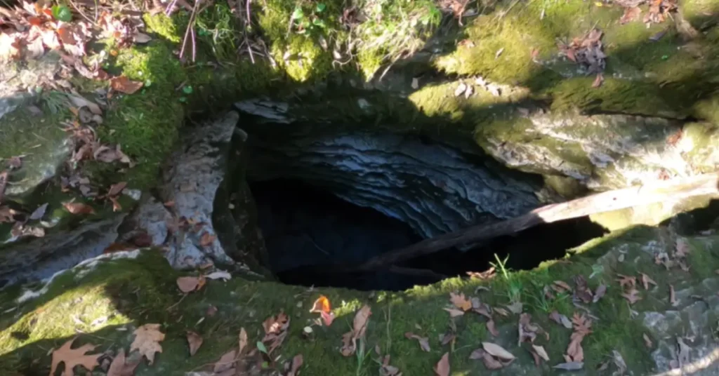
Why it rounds out the list
Karst topography, cedar glades found almost nowhere else on Earth, and a cool sinkhole “breathing” water after heavy rain combine for science‑class‑meets‑forest‑bathing.
Trail snapshot
| Metric | Detail |
|---|---|
| Distance | 4.2 mi loop |
| Elevation gain | 190 ft |
| Difficulty | Easy |
| Best season | Late May for Tennessee coneflower bloom |
| Dog policy | Leashed; keep pets from fragile glade plants |
| Parking fee | Free; visitor center sells topo maps |
Unique draws beyond competitor list
• Interpretive plaques detail rare limestone flora; carry the park’s free botany brochure to match species.
• Hidden sinkhole at mile 1.8 audibly gurgles after rains—kids love the “cave monster” sound.
• Benches every mile make this friendly to multi‑generational groups.
My field notes
• Trail crosses Cedar Forest Road twice—watch for cyclists on fast descent.
• Tick checks essential June through August; cedars harbor seed ticks.
• Combine with the 0.8‑mi Limestone Sinks Trail for a micro‑karst lesson.
Side‑by‑side trail comparison
| Trail | Distance | Elevation gain | Dog‑friendly | Water views | Best season highlight |
|---|---|---|---|---|---|
| Radnor Lake South + Ganier | 3.4 mi | 380 ft | No | Lake, ridge vista | Winter waterfowl |
| Mossy Ridge Percy Warner | 4.5 mi | 740 ft | Yes | Occasional gulley | May laurel bloom |
| Narrows of the Harpeth | 1.5 mi | 210 ft | Yes | River bend | Sunset foliage |
| Volunteer Trail | 11 mi RT | 430 ft | Yes | Percy Priest Lake | Autumn colors |
| Hidden Springs Cedars | 4.2 mi | 190 ft | Yes | Wet‑weather streams | June wildflowers |
Navigation hack
Download the free Tennessee State Parks app; offline maps for Radnor, Long Hunter, and Cedars load faster than AllTrails when LTE drops.
Gear checklist trail tested
| Item | Why I pack it | Trail where it proved crucial |
|---|---|---|
| 2 L hydration bladder | Hands‑free sipping fights Tennessee humidity | Volunteer Trail mile 8 return climb |
| Lightweight trekking poles | Stability on limestone scree and stone stairs | Mossy Ridge staircase descent |
| Tick‑repellent treated socks | Seed ticks swarm cedar glades June–Aug | Hidden Springs Loop cedar sections |
| 8×32 binoculars | Scan for bald eagles and heron rookeries | Radnor Lake eastern cove |
| Waterproof stuff sack | Thunderstorms brew fast; keeps phone and map dry | Narrows of the Harpeth sunset return |
| Headlamp (120 lm) | Bluff‑top sunsets mean dusk descents | Harpeth bluff and Volunteer campsite |
| Printed park map | Cell service fades in hollows | Cedars of Lebanon interior |
Trail manners and safety I swear by
• Stay on marked tread; cedar‑glade soils crush easily and take decades to recover.
• Pack out food scraps—even an orange peel invites raccoons that harass nesting birds.
• Leash dogs within arm’s length; bluffs drop 100 ft and protected flora lines edges.
• Yield to uphill hikers; a mid‑slope break doubles as a photo op.
• Summer highs hit 95 °F with 80 % humidity—start before 8 a.m. and drink a half‑liter every hour.
Seasonal planning quick‑view
| Month | Trail crowds | Bloom/wildlife notes | My go‑to hike |
|---|---|---|---|
| March | Light | Redbuds, migrating sandhill cranes | Radnor Lake for dawn chorus |
| May | Moderate | Mountain‑laurel tunnels | Mossy Ridge early morning |
| July | High midday heat | Fireflies at dusk | Hidden Springs shaded loop |
| October | Busy weekends | Maple and hickory color peak | Narrows bluff for sunset |
| December | Quiet | Clear lake reflections, no bugs | Volunteer Trail solitude |
Summary boots on trail
Five very different paths—ridge climbs, river bends, cedar glades, and lakeshore rambles—show Nashville is as green as it is neon. I have walked each one in every season and can promise: bring curiosity and respect, and these landscapes will answer with owls, orchid blooms, and water light that no downtown rooftop can match. Lace up, leave time for a post‑hike barbecue plate, and let Music City’s wild side score your adventure.